Using Geographic Information Systems(GIS) to Streamline Designs
GIS product made after processing aerial pictures taken from a drone. (stock photo)
Advancements in technology within the civil engineering field have significantly transformed how innovative designs are created and implemented. Improved technological tools play a crucial role in addressing infrastructure challenges, enabling engineers to continually contribute to the ongoing development of the world around us.
At CRS, we have implemented many new technologies to better serve our clients through each project. One tool we have utilized to streamline designs and provide innovative solutions is Geographic Information Systems (GIS).
What is GIS:
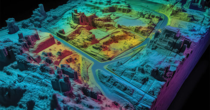
Roger Tomlinson initially developed GIS concepts in the 1960s and it has advanced through the years. Today GIS is a technology that combines geographical data with various types of information to analyze, visualize, and understand spatial relationships. Geographic data is collected from various sources such as satellite imagery, GPS devices, surveys, and existing maps. Once the data is stored, the software provides tools to analyze the spatial relationships and patterns. Additionally, it is used to produce maps and interactive visualizations with analysis results.
Benefits of GIS:
The maps and visualizations produced can be used in many fields of work to help with decision-making, planning, and communication of spatial information. This tool allows users to create maps and query data representing a wide range of information, from land use patterns to demographic data. Visualization is a crucial aspect of GIS as it helps convey complex spatial information more easily.
How is it used in civil engineering?
Civil engineers have adopted this tool to have a comprehensive understanding of the geographical context of a project. Some areas where civil engineers use GIS are site planning and analysis, infrastructure planning and design, and land planning. It is also used as a record system for inventorying assets such as property interests and utilities. Civil engineers can better communicate with stakeholders and the public by creating collaborative and interactive workspaces within a GIS environment.

Drone flying to capture footage to use with GIS. (stock photo)
How CRS uses GIS in its projects:
Our team uses GIS technology to serve many of our clients’ needs. We have and are currently working with several clients where this tool is key to support and complete their projects.
We are currently working with the Environmental Protection Agency (EPA) to provide support to revise the Lead and Copper Rule. We are supporting four Utah communities (South Salt Lake City, Sandy City, Ballard Water District, and Maeser Water District) in meeting the EPA’s requirement to inventory service lines for lead and copper. We have also set up GIS systems to help them collect and manage data and provide training to help them understand and use these tools.
Another project that utilized GIS was analyzing taxation and identifying properties that needed to be annexed or withdrawn from the Metropolitan Water District of Salt Lake & Sandy. In addition, we used GIS extensively to support the development of their Hazard Mitigation plan and are currently using it to support right-of-way acquisition for the Cottonwoods Connection project.
Another example of GISs impact is how we use it to collaborate with All West Communications to expand its fiber-optic network to several cities throughout Utah. All West Communications has used GIS to help their current and future projects in a variety of ways. We are able to use dashboards to review and collaborate to improve communication. The data can be used to:
- Create an interactive map to identify and track special permitting needs
- Track and report construction progress
- Track questions and concerns from the public and use the system to automatically notify people based on the location of the comments
At CRS, have implemented a variety of GIS strategies—from GIS maintenance, GIS creation, to custom software development utilizing the Esri ArcGIS® platform. We prioritize using advanced technologies such as GIS to provide innovative solutions in civil engineering. Integrating GIS into our projects helps us better grasp geographical contexts and equips our clients with effective tools for decision-making, planning, and communication.
For more information, contact Daniel Reynolds at daniel.reynolds@crsengineers.com